Drones plus 3D reconstruction give building owners a live, verifiable view of exterior cleaning work.
- Platform status
- In active development
- Data sources
- Imagery, LiDAR, radar, point clouds
- Client transparency
- Interactive 3D
What we shipped
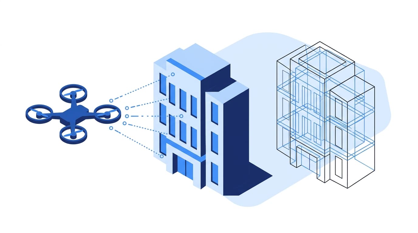
An AI and data platform that ingests drone imagery, LiDAR, radar, and point clouds to reconstruct 3D building surfaces.
Companies that clean and maintain large commercial buildings struggle to prove quality on high-rise and industrial structures. Static photos and manual reports offer clients limited visibility into coverage.
Blueprint → AI Pilot → Production launch → Scale and operate.
We followed the Datablooz Delivery Model. See our process.
- Blueprint
Defined data sources from drone sensors, target client experience (3D inspection), and the ingestion architecture.
- AI Pilot
Prototyped AI models for surface analysis, coverage detection, and 3D reconstruction on a single building.
- Production launch
Deployed the data platform, 3D reconstruction engine, and real-time operational monitoring for live jobs.
- Scale and operate
Extended to defect detection, predictive maintenance, digital twin integration, and autonomous inspection.
Business, technical, and governance outcomes.
- Interactive 3D before-and-after views per building.
- Near real-time monitoring during drone operations.
- Unified imagery, LiDAR, radar, and point-cloud data.
- Foundation for defect and damage detection.
- Python
- PyTorch
- Point Cloud Library
- Three.js
- PostgreSQL
- Cloud Object Storage
Versioned 3D artifacts per inspection and structured audit trails of coverage comparisons between sessions.
Working on something similar?
Book a call. We will tell you honestly whether AI is the right move.
Reference calls available under NDA after the second working session.